|
|
|
|
 |
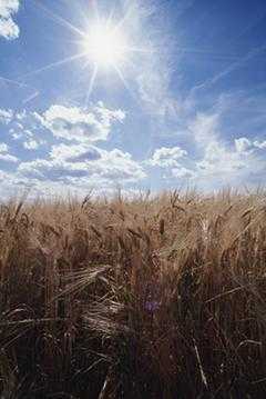
County Forecast for Wilton , ND |
 |
 |
| | 060100-
McLean-
Including the cities of Garrison and Washburn
239 PM CDT Sat Jul 5 2025
Rest of today Mostly sunny. Highs in the upper 70s. North winds around 10 mph.
Tonight Mostly clear in the evening, then mostly cloudy with a chance of showers and a slight chance of thunderstorms after midnight. Lows in the mid 50s. Northeast winds 5 to 10 mph. Chance of rain 40 percent.
Sunday Decreasing clouds. A chance of showers. A slight chance of thunderstorms in the afternoon. Highs in the lower 70s. East winds 5 to 10 mph. Chance of rain 50 percent.
Sunday night Partly cloudy with a slight chance of showers and thunderstorms. Lows in the mid 50s. East winds around 5 mph, becoming south after midnight. Chance of rain 20 percent.
Monday Sunny. A slight chance of showers and thunderstorms in the morning, then a chance of showers and thunderstorms in the afternoon. Highs around 80. Southwest winds 5 to 10 mph, becoming west with gusts up to 20 mph in the afternoon. Chance of rain 30 percent.
Monday night Mostly clear. Lows in the mid 50s.
Tuesday Sunny. Highs in the mid 80s.
Tuesday night Partly cloudy with a slight chance of showers and thunderstorms in the evening, then mostly clear after midnight. Lows in the lower 60s. Chance of rain 20 percent.
Wednesday Mostly sunny. Highs in the lower 90s.
Wednesday night Partly cloudy with a slight chance of showers and thunderstorms in the evening, then mostly clear after midnight. Lows in the mid 60s. Chance of rain 20 percent.
Thursday Mostly sunny. A slight chance of showers and thunderstorms in the afternoon. Highs in the mid 80s. Chance of rain 20 percent.
Thursday night Mostly cloudy with a chance of showers and thunderstorms in the evening, then partly cloudy with a slight chance of showers after midnight. Lows in the mid 50s. Chance of rain 40 percent.
Friday Sunny. A slight chance of showers and thunderstorms in the afternoon. Highs in the mid 70s. Chance of rain 20 percent. |
|
|
|
Bryce Anderson – DTN Meteorologist
|
| Thunderstorms Could Threaten Holiday Fun |
» More DTN Weather Commentary |
| Posted at 12:09PM Thu Jul 3, 2025 CDT |
Click here to get your local weather emailed to you each day.
|